The GIS Consortium and the Village of Tinley Park, Illinois are featured in the current issue of TRENDS. “Supportive solutions: GIS Consortium provides cutting-edge data to impacted communities” By Bob Brown Read the article here: http://www.ayresassociates.com/wp-content/ayres_images/GIS-Spring15.pdf The Illinois-based GIS Consortium (GISC) is a group of 29 communities in the Chicago region that …
Category Archive: Municipal Engineering
Oct 10
Tracking Impact of Emerald Ash Borer from Aerial Imagery
Ayres Associates is providing specialized infrared aerial imagery and LiDAR tools for urban tree canopy analysis in the Chicago area. Municipalities are taking extraordinary measures to deal with the impacts of the Emerald Ash Borer on urban forests. Aerial imagery may provide a useful tool for detecting dead and dying trees and for tracking the decline in the tree …
Sep 05
Aerial Photography Supports Ayres Survey & Municipal Projects
Ayres’ RCD30 digital camera provides surveyors with the ability to economically and quickly acquire aerial photography to support field operations. The Land Survey and Green Bay Municipal engineering groups of Ayres Associates are working with the Village of Denmark, WI (10 miles from Green Bay) in an effort to develop an industrial park on the west side of Interstate …
Aug 31
3D Urban Modeling in the Chicago Suburbs
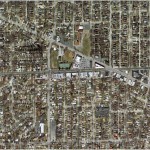
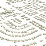
Advancements in Lidar processing tools and techniques are enabling new 3D modeling possibilities for GIS. Ayres Associates acquired high density Lidar of Tinley Park, Illinois in the spring of 2014. The primary objective of the project was the development of 1-ft interval contours and a bare earth surface model for stormwater management applications. However, there is …
Aug 26
HD Scanning – Another Tool in the Toolbox
In addition to providing high accuracy survey, HD Laser Scanning enables workload and staffing flexibility for the Geospatial Division. HD Laser Scanners create a highly detailed and precise point cloud. After collecting and calibrating the data in the field, the work of measuring and extracting the detailed information for CAD drawings occurs back at the office. This workflow represents a high …
Jul 02
Aerial Imagery Captures Recent History of Flooding in Greeley, CO
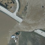
Flood events in Colorado in 2013 and 2014 have been recorded using aerial imagery- providing the City of Greeley with a valuable tool for assessing flood extent and for analyzing storm water infrastructure and improvements. In September of 2013, Ayres Associates collected aerial imagery of the South Platte River and its tributaries near peak flood stage, …
May 01
Ayres Associates Featured in Leica Article on Colorado Floods
Leica Geosystems publishes article about aerial imagery collected during the historic Colorado floods in 2013 http://www.leica-geosystems.us/en/Flooding_pdf_v3.pdf The article does a great job of highlighting the efforts of the professionals on the user end. The engineers, floodplain and stormwater managers, surveyors, emergency responders, GIS specialists, and others deserve a great deal of thanks for their hard …
Apr 29
GIS Consortium Utilizes the New UltraCAM Falcon in 2014
The GIS Consortium (GISC) successfully wraps up another spring aerial imagery mission. Approximately 130 square miles of high resolution aerial imagery was acquired for the Consortium in 2014 using Microsoft’s new UltraCAM Falcon. The imagery will ultimately support a wide range of municipal applications including engineering, planning and zoning, and public safety. We are …
Apr 20
Municipal Geospatial Partnerships
Geospatial data such as topographic mapping, aerial imagery, and planimetrics create the digital foundation for any engineering project. If you manage floodplains and storm water your first priority should be obtaining accurate up to date topographic data. Flooding is not the only application that benefits greatly from geospatial data. The potential applications for quality geospatial …
Apr 14
NoCO (Northern Colorado) Geospatial Consortium
Local municipal governments in northern Colorado team-up to build high accuracy base mapping through LiDAR and aerial imagery. Ayres Associates worked with several local governments throughout northern Colorado to form an informal consortium with map modernization as their primary objective. This group broadly consists of the City of Fort Collins, City of Loveland, Larimer …
Mar 28
The GIS Consortium – a role model for municipal cooperation
The Illinois-based GIS Consortium (GISC) is a group of 23 communities in the Chicago region that work together to develop GIS solutions to support a wide range of applications including municipal engineering, planning, forestry, and public safety. Ayres Associates has been providing high-accuracy mapping and surveying services to member communities since the 1980s. …
Mar 05
3D Building Extraction from Aerial LiDAR
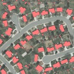
Get more information from your aerial LiDAR – beyond contours and surface models. Recent advances in LiDAR systems and software are leading to new tools for extracting valuable information from point clouds. High-density point clouds can be used to extract 3D building shapefile polygons using customized algorithms inTerrasolid’s TerraModeler software. Complex 3D building models are …




Recent Comments