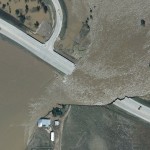
High Density Aerial Lidar of Wray, Colorado (CDOT Front Range NPS – Region 4 – Riverine Design & Analysis) Ayres expands upon its use of high accuracy Lidar for important transportation corridor design and improvement projects throughout Colorado. In the past year, our Aerial Mapping Services group has been working closely with our engineering staff …
Category Archive: Flooding
Apr 18
Droning on and on…Are drones destined for the trash?
No, drone technology is not going away. In fact, its use in the professional services marketplace is only expanding. One application we’ve developed expertise in is utilizing UAS to analyze landfills. Landfills are often run as a business, and, like any business, operators make decisions based on metrics and try to increase efficiencies to improve …
Dec 12
Geospatial Technology for Stormwater Management
Effective stormwater management can make or break a municipalities preparedness for major rain and flood events. Too often municipalities opt for reacting to major storm events, rather than properly preparing for them. Storm event preparedness is no easy feat and it often takes tremendous effort to identify and prioritize best management practices. Ayres Associates understands the …
Oct 26
Integrating UAS into Ayres Professional Services
Unmanned Aerial Systems (UAS), or drones, are becoming increasingly common tool in the survey, mapping, and engineering fields. Incorporating these aerial imaging and mapping platforms into our services is adding new dimensions and perspectives as we measure and observe project sites and structures. This technology is a tremendous tool where site safety and accessibility are …
Jul 21
Geospatial Analysis of Road Washouts
On July 11 Northern Wisconsin saw severe storms leading to millions of dollars of damage in several counties. Many roads could remain closed potentially for months greatly affecting transportation in the height of the region’s tourism season. Ayres Associates structural and highway engineers mobilized quickly to provide extremely fast-track design services to replace culverts with …
Oct 28
Cutting Culverts into Lidar DEM’s
Lidar has become an important tool for management of water resources and for designing mitigation efforts for localized flood events. While regional issues have driven topographic mapping efforts for counties, watersheds, and floodplains, the high accuracy and high definition Lidar surface models are now being applied to micro-drainage solutions. However, the lack of culvert information with these surface models can present an issue for proper …
Sep 14
Surveying Steamboat Lake – Above and Below the Water Line
Merging Bathymetric Survey and Aerial Lidar Ayres Associates is supporting the analysis of the Steamboat Lake with integrated bathymetric and aerial Lidar survey. Working with GeoSurv Inc. of Lafayette, CO, Ayres conducted a survey of the lake bottom and sub bottom – merging the data with topographic mapping collected …
Jul 02
Aerial Imagery Captures Recent History of Flooding in Greeley, CO
Flood events in Colorado in 2013 and 2014 have been recorded using aerial imagery- providing the City of Greeley with a valuable tool for assessing flood extent and for analyzing storm water infrastructure and improvements. In September of 2013, Ayres Associates collected aerial imagery of the South Platte River and its tributaries near peak flood stage, …
May 01
Ayres Associates Featured in Leica Article on Colorado Floods
Leica Geosystems publishes article about aerial imagery collected during the historic Colorado floods in 2013 http://www.leica-geosystems.us/en/Flooding_pdf_v3.pdf The article does a great job of highlighting the efforts of the professionals on the user end. The engineers, floodplain and stormwater managers, surveyors, emergency responders, GIS specialists, and others deserve a great deal of thanks for their hard …


Recent Comments